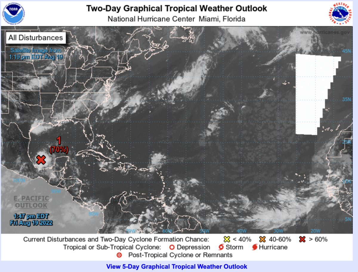
This afternoon, a tropical disturbance in the Southern Gulf of Mexico shows signs of development, while most of the Atlantic remains free of tropical cyclones. This has been the trend for most of the summer. But yesterday’s wrf model forecast shows waves passing across West Africa with abundant rain in the Western Sahel including Senegal. At the end of the forecast period on approximately August 23rd, an African Easterly Wave (AEW) is expected to emerge off the coast with the potential for development. The ECMWF and Canadian model forecast at 1200 UTC, Friday August 19 shows this wave strengthening as it moves westward.
In my experience, August 19-Oct 5 will be the time when the potential for AEWs leaving the coasts to develop into a tropical depression, storm or hurricane. At present, all meteorological factors indicate a good environment for tropical disturbances to form in the Eastern Atlantic: A strong Monsoon flow, an African Easterly Jet (AEJ) that is in the northern Sahel or Southern Sahara, a large zone of easterly winds at 200 hPA (the tropical easterly jet), and limited dust intrusions from the Sahara desert.
Looks like August 23-27 will be the first tropical disturbance to watch from West Africa, with stronger waves to follow in the coming weeks. Now is a good time to be prepared for Tropical cyclone activity as we move into the heart of the hurricane season. Check out the Hurricane Preparedness webpage for more details.
https://www.noaa.gov/hurricane-prep
If you live in Senegal, Gambia, Guinea, Guinea-Bissau please be prepared for flooding rains.