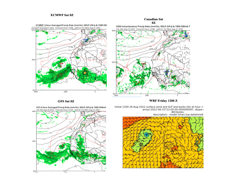
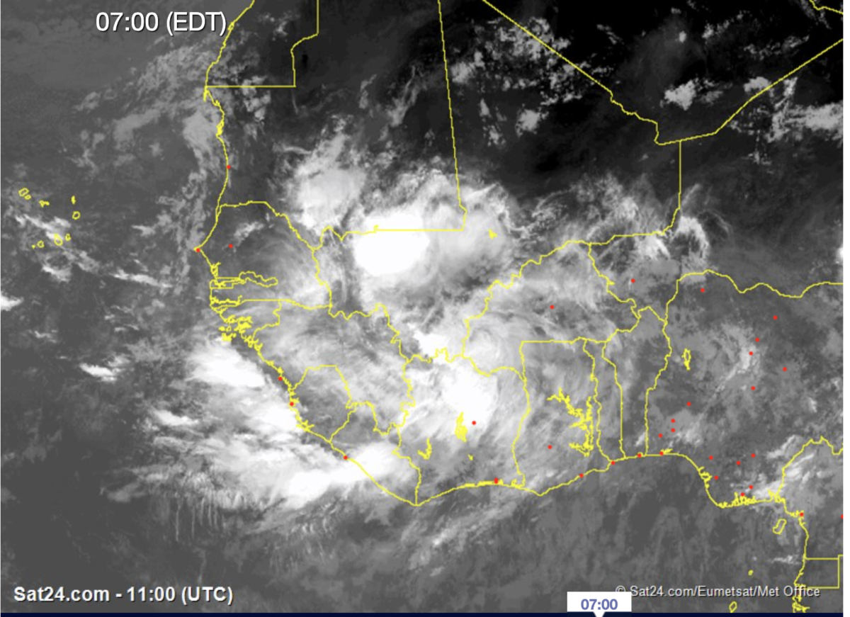
For the last few days, we have been watching global forecast models suggest that an emerging African Easterly Wave will develop into a tropical disturbance, potentially impacting Cabo Verde. As suggested in the last blog, we are now entered in the period of active TC development.
The Forecast Dilemma linked to poor observations
Examining the future forecast of 1200 UTC, August 31st 2022, an area of low pressure is found over Cabo Verde in the ECMWF, Canadian, GFS, and WRF forecasts.

The differences between these model simulations could be life giving rains to farmers or damage to the infrastructure and life-threatening seas for the fishing community. Forecasts all have inherent uncertainty, but Africa stands alone and is driven by human factors alone. The observation network has fallen apart and there are very few upper air observations across the continent. Yes, we have satellites, but I am sure that this approach could not be used in the US or Europe. If you add this to the lack of surface measurements including Radars, the forecast infrastructure resembles the 1930s in the United States, except for the use of Satellites. Is that good enough? NOPE, because we are in a warming climate with more weather extremes and growing coastal populations.
What will happen? The Devil is in the details
All of the models show that the storm over Cabo Verde next week. However, the path to getting there will be the difference maker. The ECMWF forecast the area of low pressure developing from the north (via Mauritania). The GFS and WRF show the development from further south (Guinea/Guinea Bissau) and the Canadian model shows the disturbance crossing Senegal. The ECMWF scenario may not have major implications for flooding and dangerous seas but the other forecasts (Canadian, GFS, WRF) definitely have significant consequences well before any storm arrives to Cabo Verde.
Lessons from the Past (Hurricane Fred)
Back in 2015, I was on the island of Sal when Hurricane Fred passed through Cabo Verde on August 31st. The track that the storm took was similar to the present GFS, WRF model forecast. This disturbance was also forecasted out about 7 days in advance but went through rapid intensification out over the sea. Fishermen were lost at sea off the coast of Guinea Bissau and also Cabo Verde. Damage occurred on numerous islands across Cabo Verde. Along the coast of Senegal, the damage was widespread across many coastal fishing villages and the capital of Dakar. We made recommendations about how to better protect the populations in the manuscript. Nothing has since happened. The value of journal articles.
The Next 96 hours
While we do not know, the exact path of the tropical disturbance, it is prudent to expect potentially dangerous conditions, potentially impacting millions of people from Guinea, north to Senegal and to the west in Cabo Verde. The following hazards are likely
Flooding
All of the models tend to poorly represent rainfall so we must estimate based on what the models project. 100-200 mm of rainfall (5-10 inches) are possible with the passage of the system. The heavy precipitation will commence by tonight through the next 2-3 days in coastal zones–including Dakar.
Dangerous seas
If the disturbance develops off the Guinea coast, dangerous seas should be expected throughout the entire zone. Coastal flooding could threaten fishing communities from Guinea to Dakar, Senegal. The longer the system is off the coast, the more likely it is to generate a southerly fetch to drive coastal flooding in some areas.
Cabo Verde
Based on the current forecast, a tropical depression seems possible but it could be worse. The 1200 WRF forecast suggests a tropical storm moving across the country on 31st. Too early to tell if this scenario plays out but it would likely yield coastal damage from the seas, and strong winds, with potential flooding in some areas.
Pay attention please to your local news
We are in the most dangerous part of the monsoon season in West Africa, with major flooding events over the last 3 years across the region. Senegal and Cabo Verde have both experienced such events. Similar to the US coastal population, you are vulnerable and should have a plan to protect your life, loved ones, and important documents.
The most important thing is to pay attention to the local news over the next few days. Reports of flooding or damage via social media are good given the lack of observations in the region.
Stay Safe, listen to the news, evaluate your state of preparedness, and we will continue to analyze upcoming forecasts and observations.
