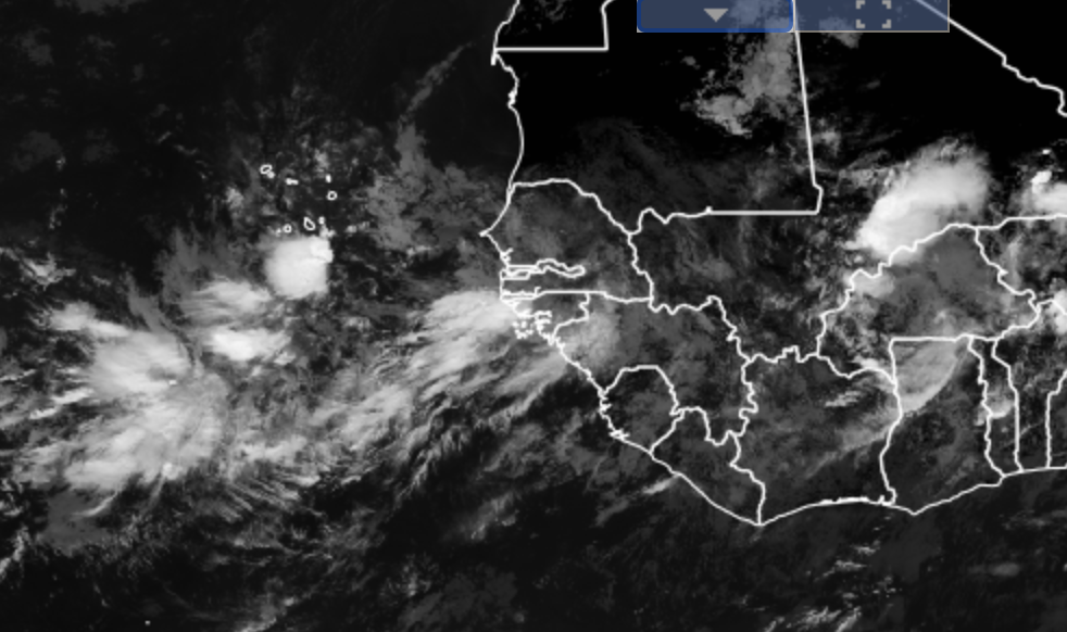
For the past day or so, a relatively stagnant pattern has developed near coastal West Africa with a traffic jam of disturbances (they are not moving westward as normal). As of today, weather disturbance over the ocean is expected to merge with the disturbance that just emerged off the coast of West Africa.
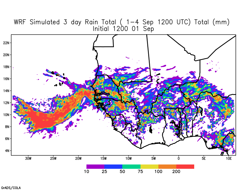
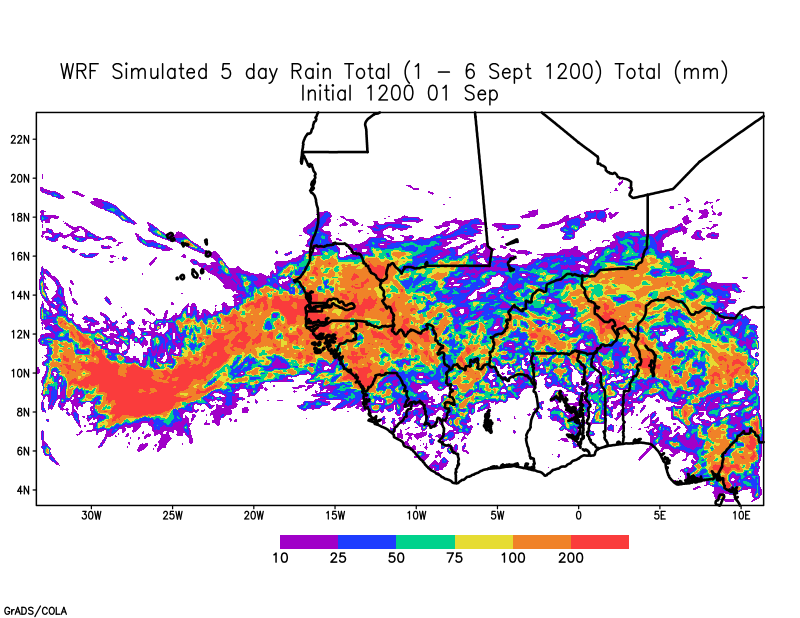
The weather system is then to pass over the country of Cabo Verde providing much-needed rain for farmers. However, the air is very unstable and likely to bring heavy rain to Senegal and Guinea Bissau tonight and tomorrow (Last night Senegal saw heavy rain from a Squall-line). This will be followed by another weather system that has the possibility of bringing more heavy rain to coastal West Africa. Some models have suggested that this second system will develop and maybe a tropical depression. At this point, it is still too early to tell but yesterday’s WRF model run forecasts heavy rain in Senegal and Guinea Bissau
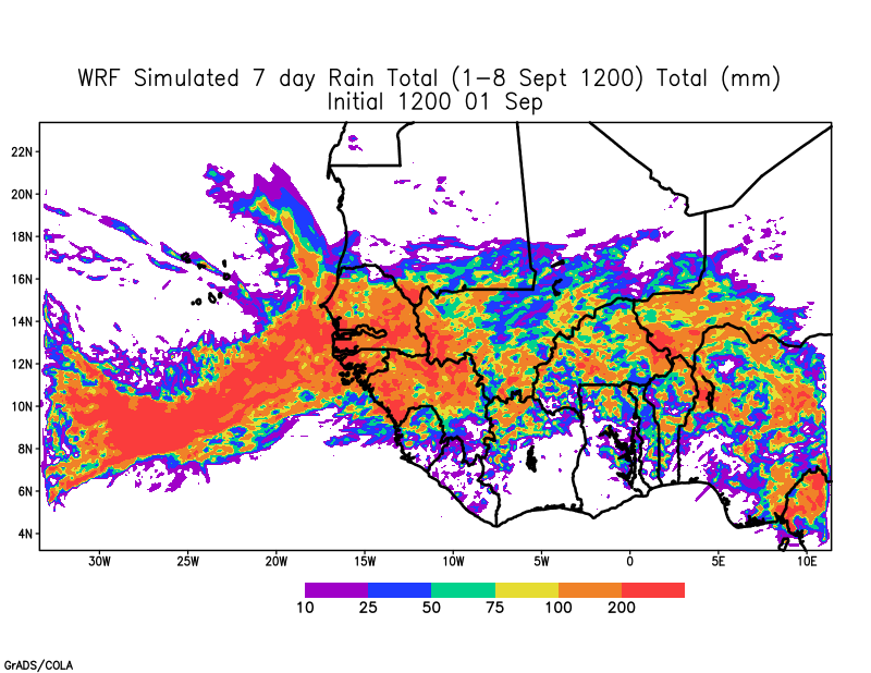
The rain is particularly heavy along the coasts on 7,8 September because the surface low exits Senegals and then moves north, missing Cabo Verde. However, today, September 2nd Global forecasts are suggesting that the storm may pass over Cabo Verde. The high-resolution model simulations are still running as of this post. Here is the sea level pressure animation from yesterday.
Main take away point:
- Heavy rain over Senegal, Guinea Bissau over the next 5 days
- Possible disturbances to impact Cabo Verde tomorrow and Friday and potentially next Monday
- Stay tuned