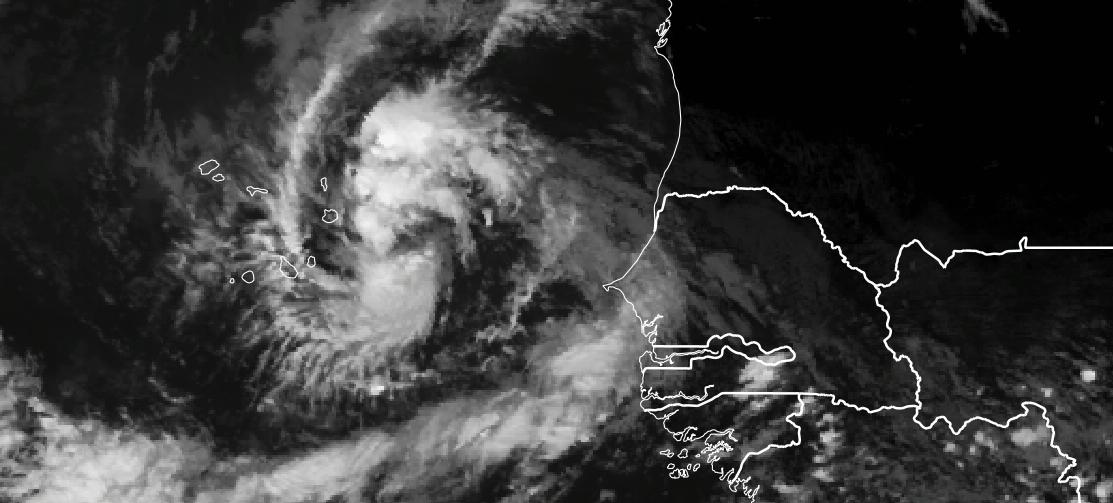
In the next few hours, Cabo Verde will begin to experience the effects of Tropical Depression 18. This is earlier than expected based on earlier forecasts. The Islands of Boa Vista and Sal should expect heavy rains and winds that may reach tropical storm force values. It is likely that the entire country will see heavy rain from this storm and that the northern islands could be impacted the worst at this time.
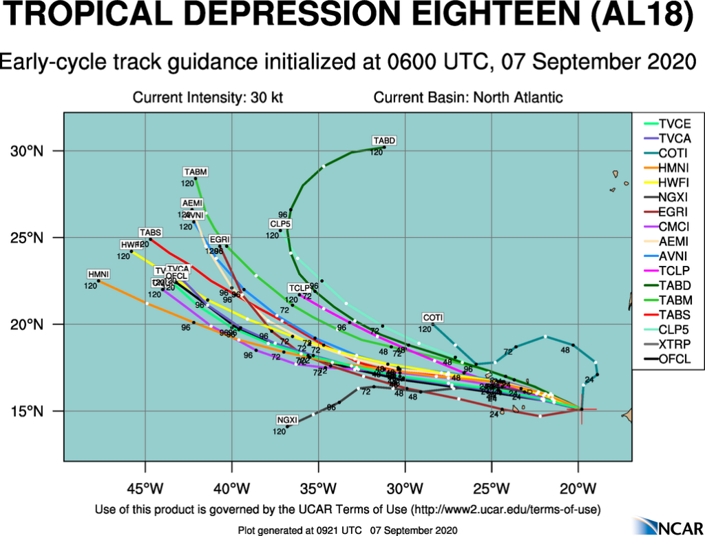
The Early Track guidance suggests that the center of the storm will come closest to Boa Vista this afternoon and then tonight will move very close to Sao Nicolau, Sao Vicente, and Santo Antao. TD-18 will continue to strengthen as it cuts through the country and is likely to be a tropical storm when it reaches Boa Vista, Sal, Sao Nicolau, Sao Vicente and Santo Antao.
WRF 0000 SEPT 7 Output Analyses
The WRF simulation from last night provides some insight of what is possible over the next 18 hours
Initial Rains
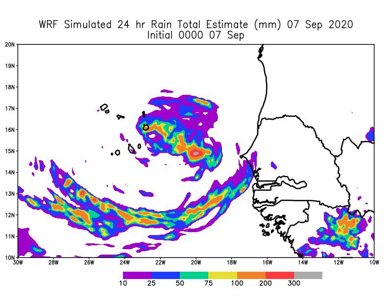
The model suggest that the first rains will reach Sal and Boa Vista around 2000 UTC tonight. Satellite observations show that the first bands may arrive in the next few hours. I expect that when the main center arrives that the rain will be pretty heavy and extend southward to Santiago.
Sea Level Pressure
Based on the WRF forecast, the low will pass close to Boa Vista and Sal with tropical storm winds likely based on the latest NHC projection. During the night the low may pass over Sao Nicolau and then Sao Vicente and San Antao before continuing out to sea tomorrow afternoon. Because there are some high mountains, winds speeds and rains in these areas are likely to be enhanced.
Surface Wind Speeds.
Surface Winds speeds are likely to increase during the day as the storm deepens. Tropical Storm force winds can be expected over most of the Northern Islands, however these winds could be reached when rain bands pass by any part of the country.
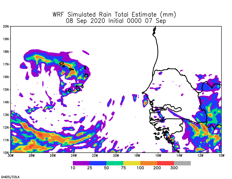
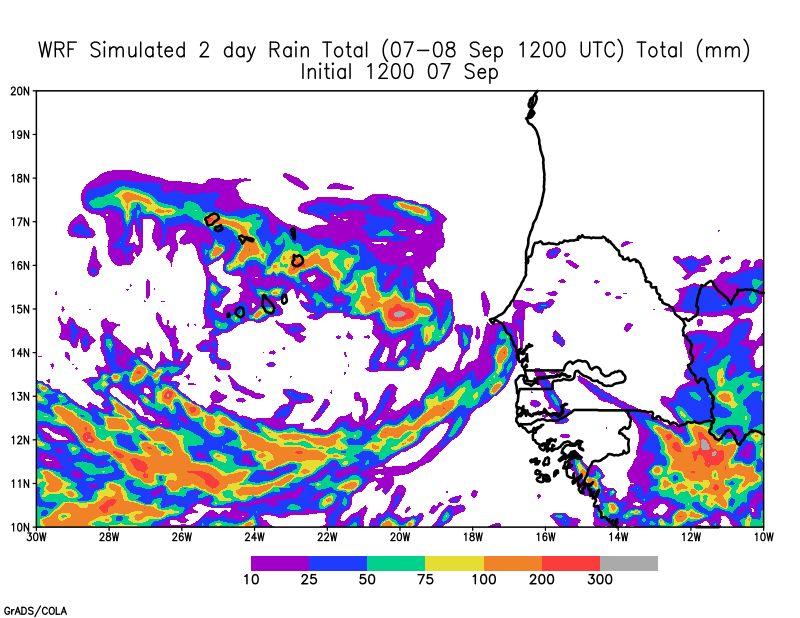
WRF Rainfall Totals
Rainfall will be heaviest over the Eastern part of Cabo Verde tonight and then shift to Western Cabo Verde overnight. The 48 hour totals could reach 100-200 mm and could be higher in elevated regions. The rain will be intense when it does occur.
Key Takeaways
- Make Final preparation for the storm now!! Charge your phones, fill your cars with gas and finish food shopping now. Touch based with loved ones before nightfall to make sure they are in good shape. Expect first rains in Sal, Boa Vista next few hours and poor conditions in about 5 hours.
- Heavy rains could produce flash flooding, so be ready to move quickly if required to safety. Mountainous regions of Santiago, San Nicolau, Sao Vicente and Santo Antao are vulnerable to flash flooding tonight and tomorrow morning.
- If you live near coastal zones, you will likely get some coastal flooding even for Islands to the south as a south fetch may produce heavy rains.
- Some storm surge is expected Sao Nicolau, Sao Vicente and Santo Antao, if the storm passes the the south of these islands and even in the eastern parts of the islands based on the wind direction.
- Please tune in to your local station to determine what is being done to protect people on your island and also know if there are local shelters.
- Please pay attention to fallen trees and down electric power lines and wait until daylight tomorrow to assess the situation. Do not go out into the storm please.
- Keep a cool head and prepare!!
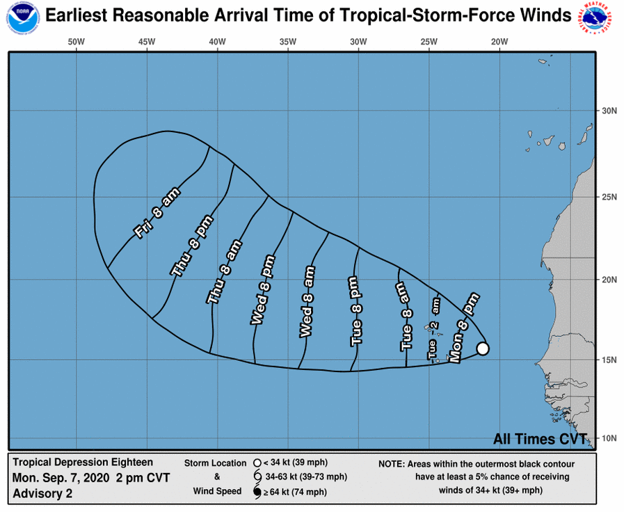
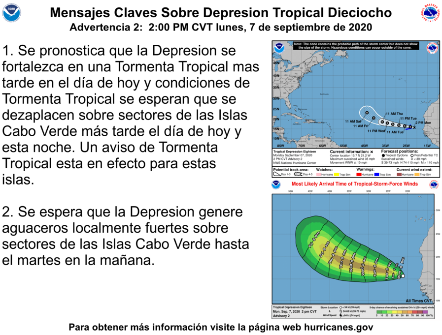
Below are images from National Hurricane Center (1500 UTC)