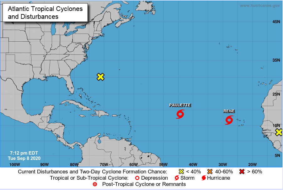
While I was focused primarily on yesterday’s storm, the 1200 UTC forecast also showed that two potential storms would emerge this week.
Potential TC #1
The first is a wave that could move quickly across the Atlantic and impact the Caribbean next week. The global models have all picked up on this feature and the hurricane center gives is an 80% chance of TC formation over next 5 days.
The WRF model shows the system off the coast of West Africa Thursday at 0000 UTC. The sea level press is expected to decrease over time as the storm organizes itself on September 12. It is a fast mover that is for sure. We will follow it with tomorrow’s forecast.
Potential TC #2
The second system is less discernable in the early part of the week and will initiate from a low amplitude AEW in low latitudes. It will gain latitude and finally is off the coast of Senegal on September 12 before passing onward into Cabo Verde. This is not that different from the system that produced Tropical Storm Rene and needs close watching. The potential to bring additional heavy rain to Senegal has me worried about the upcoming weekend.
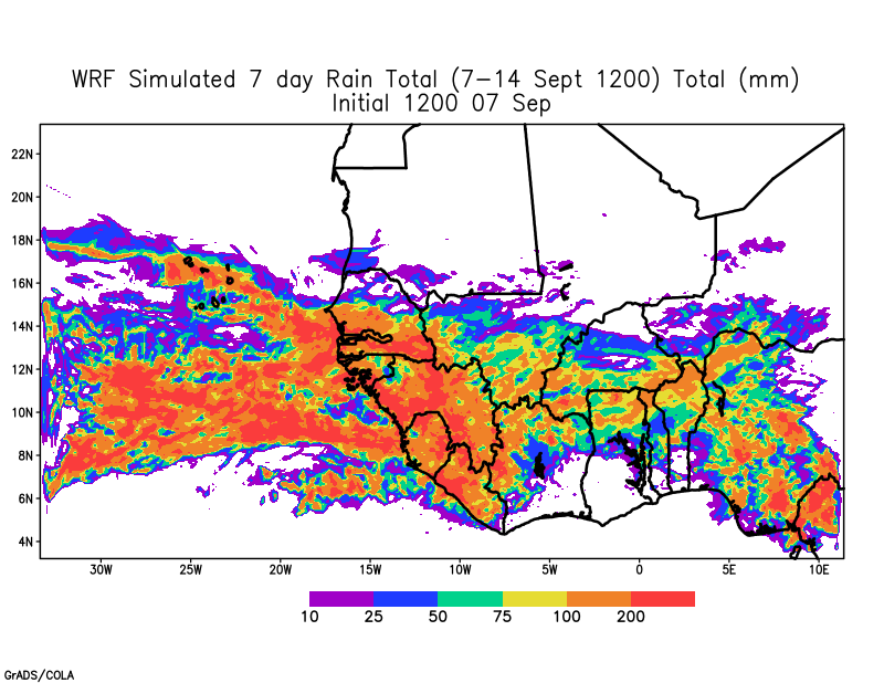
Once again, the African Easterly Jet is expected to provide energy and spin to the system that may form off the coast on Friday. Let’s see what tomorrow’s forecasts say.
The potential for active and potentially dangerous disturbance for coastal West Africa and Cabo Verde remains high. Stay vigilant!!