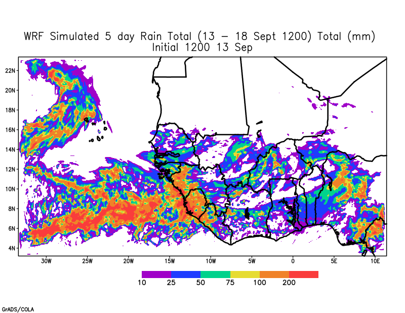
After two weekends of flooding in Senegal and Cabo Verde, this has been a quiet week. The African Easterly Wave (AEW) that emerged from the coast is moving steadily towards the west across the Eastern Atlantic and may become a tropical cyclone in the days ahead. The lack of waves this week gives much of West Africa and Cabo Verde a chance to dry out. The seven-day forecast that was run on Sunday provides a verification that there are no large-scale currently crossing the continent during mid-week based on 700 hPa vorticity.
Consequently, forecasted rainfall across the Sahel is expected to be less during the week and also shifted to the south.
Inland Disturbance will move to the coast by week’s End.
The WRF forecast shows that a disturbance will reach the coast next Sunday. Further, the WRF forecast at 850 hPa indicates that the disturbance has a northern and southern component. In these situations, the AEW is in phase and could emerge as two different disturbances or merge into one storm. One worrying trend is that global models are suggesting that the main disturbance over Mauritania will have a more southerly latitude potentially impacting countries to the south.
We will have to watch the forecast more carefully starting tomorrow. Meanwhile, keep those along the Gulf Coast in positive energy and thoughts as they prepare for Hurricane Sally and Bermuda after they experienced Hurricane Paulette.
Peace everybody