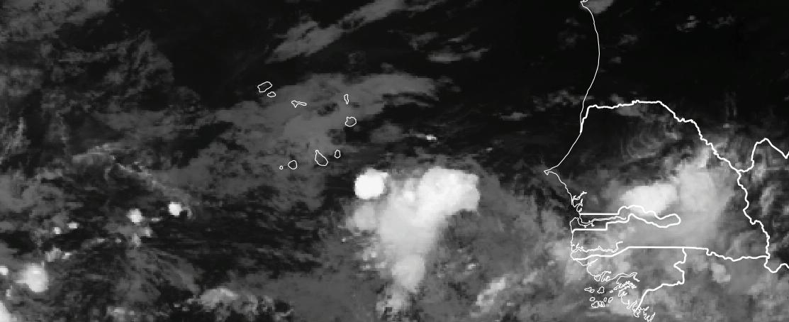
Today, I have been waiting for insights from the model forecast in determining where an area of spin and area of persistent thunderstorms would form off the coast of West Africa. This area would represent a possible threat to Senegal or Cabo Verde depending where it happened. Tonight that area may have appeared to the southeast of Cabo Verde. The weekend forecast has been very complicated because yesterday’s forecast suggested that an area of low pressure would form to the east of Cabo Verde and today’s forecast to the west. The global models were suggesting a varied solution, but one strong possibility of heavy rainfall over Cabo Verde this weekend seemed likely. Let’s break down what we know..
The coastal disturbance
The disturbance has been difficult to determine because of its interaction with a larger disturbance that exited the coast on Thursday and is likely to become a tropical cyclone in the coming days. The models have suggested that the new disturbance would break away on its own with an area of low pressure developing in the Western part of Cabo Verde on Saturday before moving off to the northwest.
However, at 5000 feet above the ground, the 850 hPa relative vorticity distinctly shows that the disturbance would be south of Cabo Verde and pass to the west of the country.
The model forecast show potentially southerly strong winds (30-40 knots at the ground) over Cabo Verde as the disturbance moves by the country on Sunday September 13.
RAIN Amounts during the Weekend
This is another problematic area. The Global model (GFS) suggest very heavy rain over the next 72 hours with the disturbance moving very slowly across Cabo Verde. These values exceed 100 mm (4 inches of rain) over the 72 hours and would likely produce flooding in Santo Antao


The WRF model on the other hand shows the heaviest rain to the west of Cabo Verde. This occurs because the area of low pressure moves off to the West of Cabo Verde. However, if the initial area of low pressure is to the east of Cabo Verde as tonight’s satellite images show, then all of the rainfall would be displaced further to the east and potentially impacting most of Cabo Verde. Gotta watch this one.
Key Take away points
- The threat of heavy rainfall in Senegal from the coastal disturbance has diminished. This will have the soils to dry out this weekend, but there may still be localized rains.
- Deep convective clouds have been building over the last hour to the southeast of Cabo Verde. These are likely to produce rain over the country over the next 6-12 hours.
- The threat of heavy rain and strong southerly winds will persist through the next 60-72 hours in Cabo Verde depending on if and where an area of low pressure develops.
- Flash flooding could occur in elevated areas of Santiago and Santo Antao.
- If you live in Cabo Verde, please follow the weather closely tomorrow through Monday and be prepared for heavy rain.