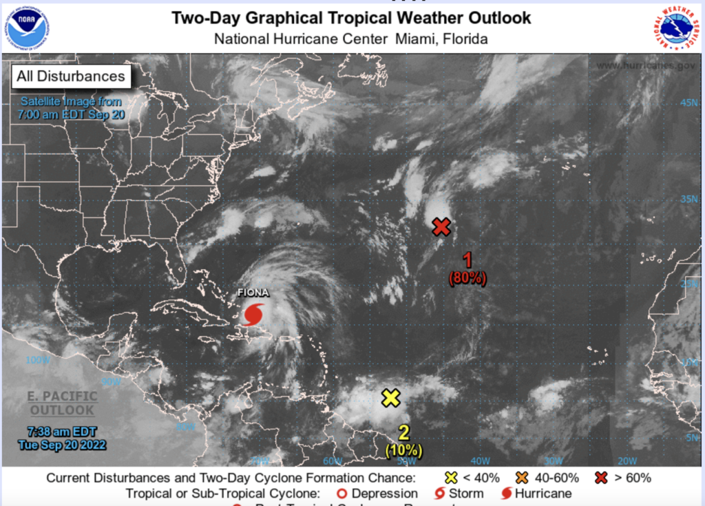
Over the last 10 days, disturbances from West Africa have moved into the Eastern, Central, and Western Atlantic. Unlike the month of August, the waves have not dissipated but continued westward, even in the face of vertical shear. The formation of destructive Hurricane Fiona was such an example. Two additional waves over the Central and Western Atlantic have the chance to become tropical systems over the next 7 days. A third wave situated near 30 W also has a chance to develop. So September might turn out to be quite different from August.
The Source of a Flooding Threat for Senegal
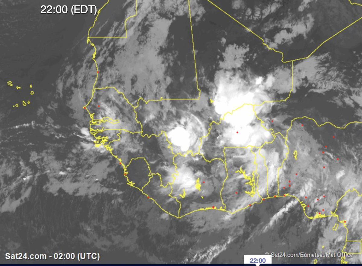
On Monday evening, a new and potentially powerful African Easterly Wave is moving across Burkina Faso and bringing rain over the Central Sahel region. Since last week, global models have identified this feature as a possible tropical cyclone once it exits into the Atlantic. But prior to the AEW leaving West Africa, all indications are that the disturbance will first cross Senegal. The system is expected to bring heavy rain and strong winds to Senegal and the extreme Eastern Atlantic Ocean.
Time of dangerous weather in Senegal
As you may know, tropical rainfall amounts are difficult to predict because of the smaller scale (meso-scale). However, the global models and WRF suggest that heavy rain could begin entering Senegal as early as tomorrow as the wave moves westward. Tomorrow night (Wednesday 21, Sep) through Thursday (22 Sep) look like potentially big impact days with heavy rain moving into Senegal as the system exits the coast.
Any Impacts for Cabo Verde ?
It is still too early to tell, but the global model and WRF suggest that the wave will get pulled north because of a mid-level trough at 500 hPa and not strike the country. Still, this tropical disturbance may have an impact on artisan and commercial fishing along coastal Senegal and Mauritania. There is a possibility that it could become a tropical depression or storm before weakening through shear
Key Takeaways
- Flooding and severe weather possibilities in Senegal will increase starting Wednesday, Sept 21 through Thursday, Sept 22;
- Rainfall could be heavy during the night-time hours of Wednesday and Thursday;
- A tropical depression is possible off the coast of Senegal/Mauritania;
- At present, the event might miss Cabo Verde, but some monitoring and awareness of the event are required through Friday, Sept 23;
- Wave activity is still active and likely to impact land areas of West Africa, Cabo Verde, and downstream over the Western Atlantic and the Gulf of Mexico in the coming weeks.