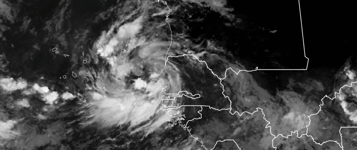
When I woke up this morning, I did not expect to see an organized tropical disturbance, with clear cyclonic flow and banding. The last time that I saw this type of organization for such a large system was 2006, when TD-8 formed off the coast of Senegal during the NASA African Monsoon Multidisciplinary Analysis (NAMMA) campaign. However, that system was further south and many hundreds of miles more out to sea.
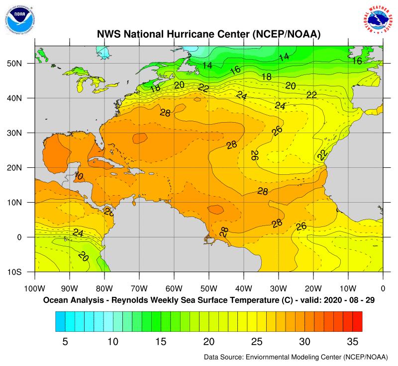
The global models are still not developing this system into a tropical cyclone near the coast, but I would say that the satellite observations should be enough to see the potential development. Ocean temperatures are above the threshold needed for tropical development (26 C) to occur and warm temperatures extend westward across the Atlantic to the United States.
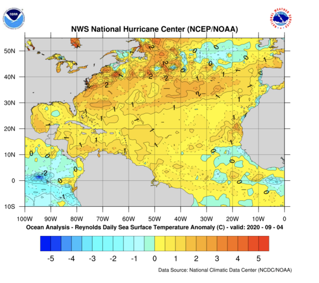
The latest Sea Surface Temperature anomalies show that waters off the coast of Senegal are 1 Degree C- 1.8 F) above normal which may provide additional energy for the storm to develop.
Key Takeaways
- The tropical disturbance is organizing and is larger than suggested in model simulations. Over the next few hours, I feel that this will be an Invest and additional high-resolution hurricane models will focus on the system. For real-time images you can go to CIMSS http://tropic.ssec.wisc.edu/# as they are now following the system, just click on the invest (I).
- Senegal –
- expect additional bands of heavy rain, today until the system moves away. Please careful for flash flooding and standing water on the roads.
- A strong fetch from the south will occur over the next day and coastal flooding may become a real-possibility to many fishing communities and Dakar.
- Pay attention to the national meteorological services, local TV, and Radio broadcast on weather conditions. If possible report your conditions via social media. Check-in with Raid on facebook at: La Météo Dakaroise de Riad
- Cabo Verde– You should prepare for:
- several days of rain and wind, with the possibility of tropical-storm-force winds on some of the islands.
- The seas will be rough and coastal flooding is also possible. Fishermen should be careful.
- In areas that are flood-prone or have steep hills also prepare for possible flash flooding especially tomorrow and Tuesday. This includes the city of Praia where the houses tend to sit on steep hills.
Until later… Stay safe and will update this evening……