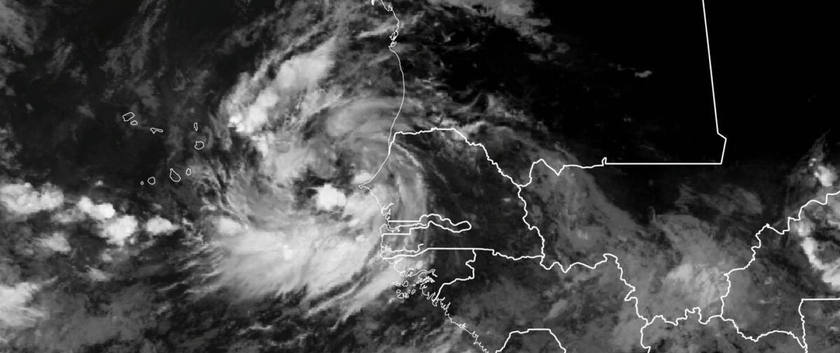
On Tuesday afternoon, Senegal and Cabo Verde were finally clear of the bad weather from TS Rene. Flooding was the main impact across both countries from TS Rene. While the models had been suggesting some development, what manifested was not expected entirely. WRF had been suggesting the heaviest rains in Western Senegal. But the large vortex that emerged was shocking.
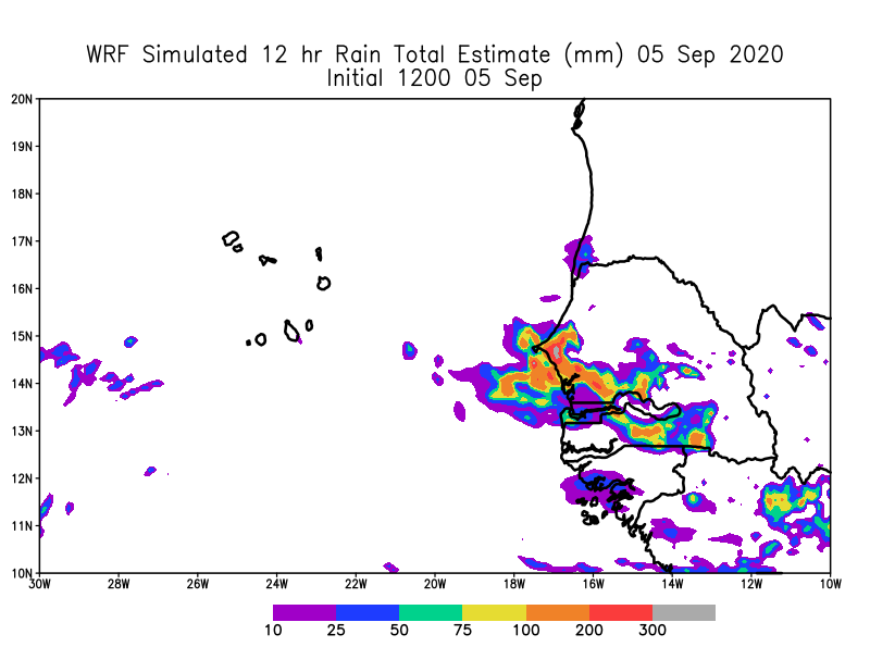
Satellite images suggested very heavy rain and the irain product suggested that rain was heavy and the WRF forecast model was suggesting up 12 inches of rain in some places. Below are videos from Senegal including Dakar, Mbour, Thies and Diamdiadio (western Senegal) that were sent to me from colleagues by whatsapp and taken by video from people in those regions.
You get the point, that the situation was serious and potentially life-threatening for people and animals. I am going to comb through the surface observations this morning to get a sense of what fell on the ground.
Cabo Verde
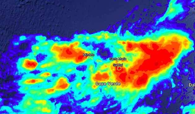
Tropical Depression 18 and then Tropical Storm Rene passed directly through the center of Cabo Verde. However, the reports are that it escaped heavy winds but there were reports of flooding in Santo Antao the more northwestern island which is very elevated. Satellite rainfall estimates suggest that Boa Vista, Sao Vicente and Santo Antao all received the highest rainfall. Of course, this all needs to be verified by ground measurements.
While, we can attribute this type of flooding to climate change, because of its association with a tropical disturbance, the atmosphere can hold more water vapor on a warmer planet. This will eventually manifest itself in heavier rainfall. Coastal West Africa and Cabo Verde are vulnerable now and definitely in the future unless CO2, Methane and other greenhouse gases are reduced. Because of these locations are situated near the Atlantic Ocean, disturbances have a moisture source to tap and as stated earlier the atmosphere can hold more water in a warmer world. There is evidence in the scientific literature that this is what is happening in West Africa, with heavier rainfall events over the last 2 decades. Future modeling studies by my colleague Dr. Bamba Sylla show that heavier rainfall events will manifest later this century with higher greenhouse gases.
The question that I have always struggled with is when does this happen?, is it gradual or is there a critical value with a tipping point?, after which, we never go back to earlier conditions. All of this feels like climate justice issue for the people in Africa who in general have historically contributed very little to the global burden of greenhouse gases. However, Africa’s its population increases and the use of fossil fuels increase it will contribute, which is why we need a different trajectory for the continent –> Solar energy, electric and hybrid cars and low-emission factories. The technology exists but is not readily made available to the continent and when it is, it is very expensive. Africa please unleash your innovative genius, because it is needed now!