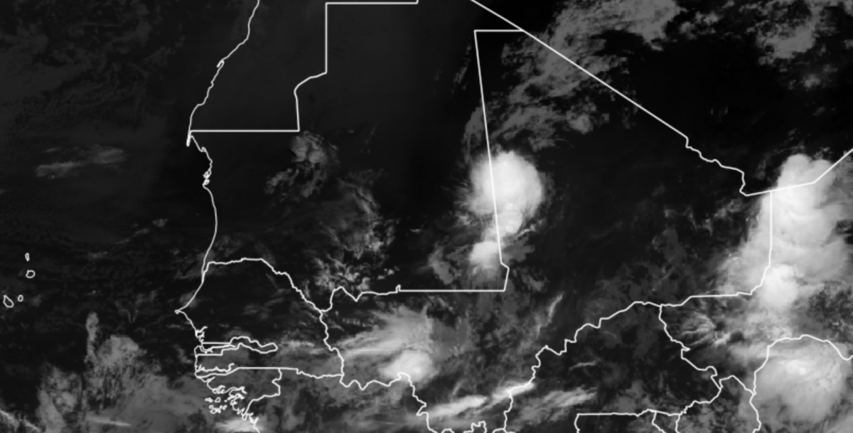
This morning, when I saw rainfall over Northern Mali, I thought that this is certainly a strange wet season. Southern Mali, yes but northern Mali is the Sahara Desert.
As I mentioned in an earlier blog, the African Easterly Jet is very far north, and based on WRF analysis is generating new disturbances at 10000 feet off the coast of Africa in addition to the normal 3 to 5-day waves the move across all of West Africa. All of this adds up to a busy next few weeks with these disturbances leading to potential tropical cyclone activities
All of this is adding onto the already active Tropical Atlantic. A long-range 14-day WRF forecast (initiated on Saturday Aug 29) shows westward-moving waves at 10000 feet (700 hPa) with 5-6 waves over the 2-week period.
Interesting Forecast for Cabo Verde
As the National Hurricane Center has noted, there is the possibility of an AEW developing once it leaves the coast of Africa in the next few days. The WRF model depicts the system impacting Cabo Verde at the end of the week but it does not look like a very strong storm. We will see.
The main disturbance that the NHC mentions is likely to combine with a disturbance that is forecast to be off the Coast of Guinea-Bissau tomorrow as depicted by the 850 hPa.
The model also suggests that the relatively weak disturbance off the coast of Africa gains vorticity (Spin) from the African Easterly Jet (AEJ) to its north. The AEJ remains strong throughout the next 14 days with disturbances being generated to the south of the Jet. There is also strong flow from the Atlantic to feed the waves.
An even strong Disturbance in one week exiting Africa (Sep 5-6)
As you may have noticed in the videos, a very strong disturbance at 5000 and 10000 feet develops at the end of the WRF forecast. While this is a long-range projection we need to watch it. The Canadian and ECMWF models are picking up this disturbance in today’s forecast (http://moe.met.fsu.edu/tcgengifs/).
The WRF depicts a tropical cyclone impacting Cabo Verde around the 7th of September. Either way, this next week is going to be active in the Caribbean and Atlantic. Stay prepared.