This year we have observed four named storms. Not a whole lot to write home about, but what is noticeable is that the first two came from Africa… kinda Cape Verde tropical storms. However, consider all the abnormal weather we have seen thus far in the US this summer – dry spells, heat waves, floods, and wildfires. Should you worry about this year’s hurricane season? Based on the trends over the last few years, we should be concerned. However, we also are in an El Nino year, which typically means fewer hurricanes because of increased wind shear. Well, what are the reasons for worry:
- Above-normal ocean temperatures
Ocean temperatures across the Atlantic, Carribean warmer across the Atlantic from Africa to the Gulf of Mexico.
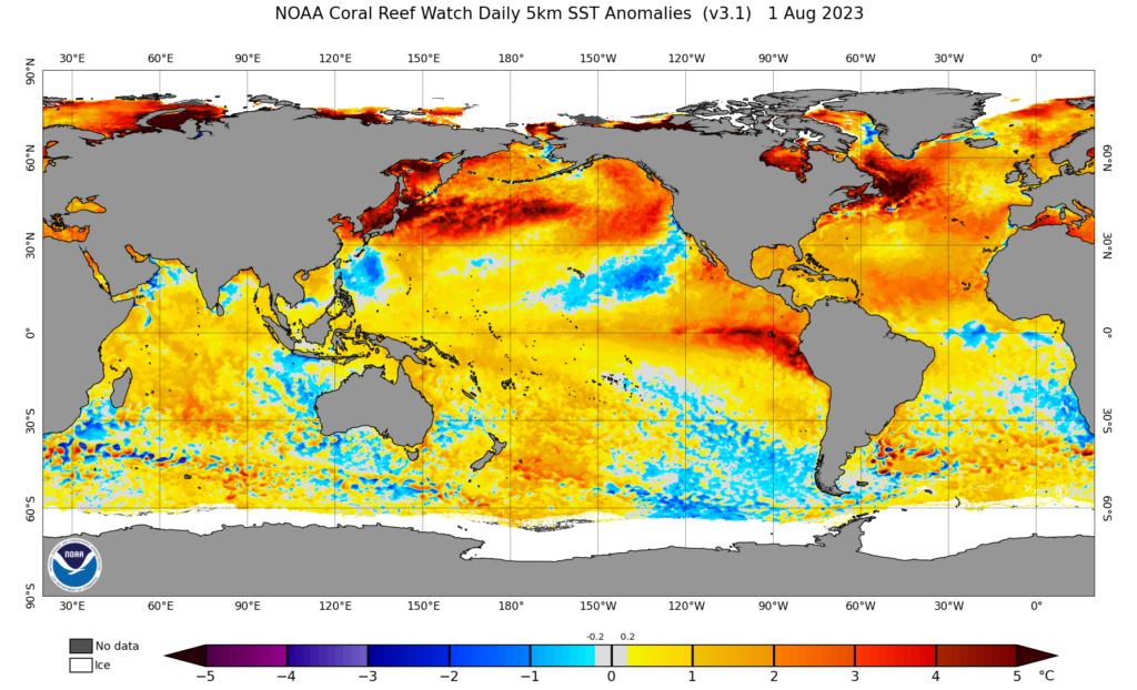
As ocean temperatures continue to warm through October, developing tropical cyclones will have warmer than normal waters to pass over possibly leading to stronger TCs. This year oceans in the Northern Hemisphere have been outright warm. Across the tropical Atlantic, the lack of Saharan dust events has also contributed to warmer than normal ocean temperatures, because normally dust scatters sunlight and leading to cooler ocean temperatures.
2. The West African Monsoon is active
We are about to enter into the mature phase of the monsoon, which is normally August and September. Consequently, moisture from the Atlantic Ocean and the Gulf of Guinea has been surging to West Africa from the ground through 3000 feet. This will should strengthen westward moving mesoscale convective systems (MCSs), leading to potential flooding in West Africa, and when in phase with emerging African Easterly waves could become tropical depressions soon after leaving the coast of West Africa.
3. African Easterly waves are looking stronger over West Africa
Normally during the second to fourth week of August, AEWs become apparent as they cross Nigeria as well-defined circulations at about 10,000 feet. Over the last few years, there has been a combination of the typical AEWs and the generation/intensification of waves just off the coast, because of fast-moving winds that generate spin (vorticity). Thus far, the second type of wave generation has been occurring with a disturbance currently developing off the coast of West Africa from the satellite vantage point this evening.
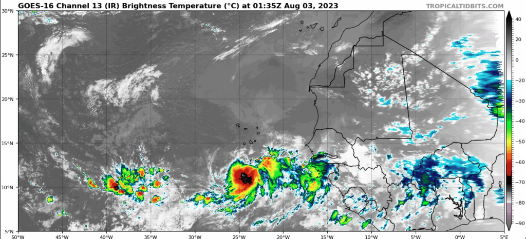
Caption: GOES 16 Image showing emerging disturbance off the coast of West Africa (Wednesday 21:35 EDT).
However, at the beginning of this week, models began to forecast well-defined AEWs moving across Chad into Nigeria and moving westward. It could mean that we are ahead of the curve and should expect the stronger wave activity to commence.
Prepare just in case…. OK
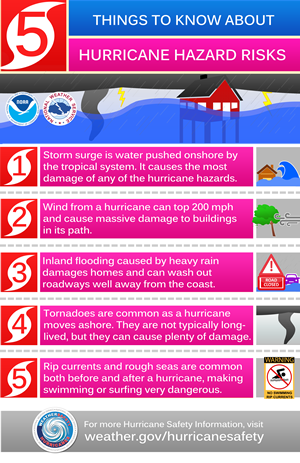
No matter where you are, you should be thinking about the impacts of tropical cyclones during the climate crisis. A hurricane does not need to make landfall in your location to cause major problems. Flooding is a important outcome of decaying tropical cyclones and can be very damaging and also lead to loss of life. Wind damage and storm surge for those living near the coast are primary threats. Below are the five Hurricane hazard risks
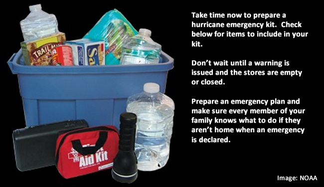
Finally, think about putting together a hurricane emergency kit and make sure you consider children, the elderly, and pets. Now is the time!