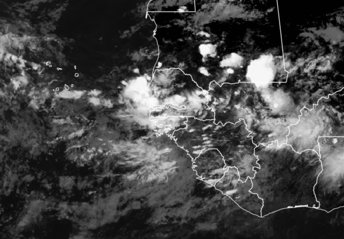
A serious weather scenario is evolving in Senegal today and potentially over Cabo Verde at the beginning of next week. Unlike the powerful African Easterly Waves (AEWs) that typically pass at this time of year, these waves have been complex over the last week. The AEW that gave Cabo Verde good rain, is now moving towards the west and likely to become a named tropical cyclone in the next few days.
A new way is projected to develop today and will bring potentially heavy rains to Senegal and Guinea Bissau. It will then slowly move out over the Atlantic and deepen on Sunday and parts of Monday before impacting Cabo Verde. The WRF model runs, which are initialized by the US GFS model have been consistently developing what would be a tropical storm to impact Cabo Verde. It also suggest a second tropical cyclone will form later next week.
The forecast winds from yesterday’s model run are tropical storm force with the heaviest winds impacting the northern parts of Cabo Verde.
Heavy Rainfall in Senegal
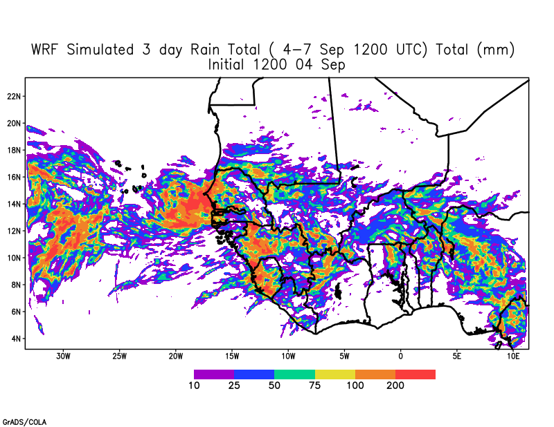
Since Thursday, the WRF model has been projecting heavy rain over Senegal beginning today through Sunday as the storm develops in the next 24 hours, with the western parts of Senegal receiving significant rains, including Dakar. The rain in Western Senegal is picking up this afternoon.

The simulated DBZ values suggest that rainfall amounts could be high through tomorrow noon in Senegal and the Gambia in coastal zone.
Is this Normal??
Typically this is the time of year when ocean temperatures are warmest and develop is possible. However, I feel that the northward position of the African Easterly Jet and its above normal strength is feeding energy (zonal kinetic) to disturbances off the coast of Senegal which would normally only amount to a minor disturbance. This has to be watched over the next 4-6 weeks
Key Takeaway:
- If you live in Senegal, be prepared for heavy rain tonight and tomorrow
- If you live in Cabo Verde…please pay attention to the news.
- Stay Tuned… for the next forecast later today.
