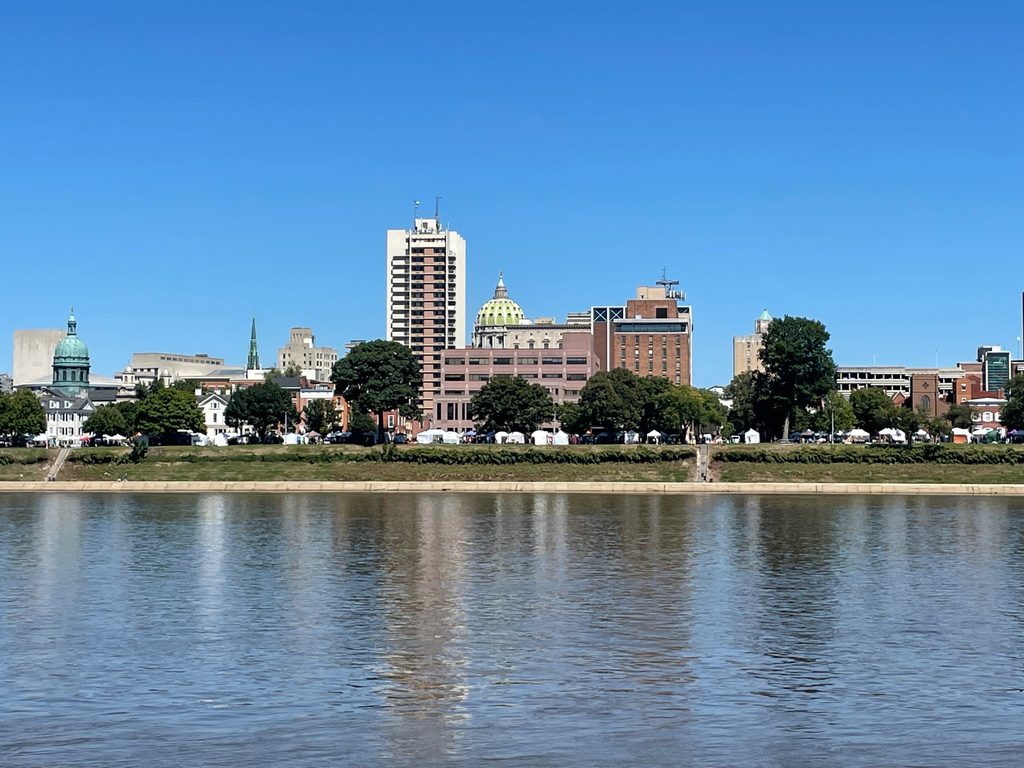
Harrisburg is Pennsylvania’s capital, with a beautiful downtown area. The lawmakers from all over the state have offices here and the state government is also here. But if you live here, a few subtle questions come to mind. Why is downtown so small? Why does downtown look deserted on weekends? Why are there so many trucks in the town? The city is small, with a population of about 60,000 residents. The city is also poor, with one Giant brand grocery store, not many banks, and a school system that was under receivership until recently. According to statistics, this is a black and brown town where people of color make up more than 70% of the population. There is something empowering about that, even with the challenges. I moved to this area in 2019 and fell in love with the city, its diversity (> 70% people of color), the beautiful river, and the mountain view. The people are pretty cool, too!
Pollution and environmental justice became my focus when I taught a class on climate justice in a freshman seminar at Penn State. I also had a bright high school student from Harrisburg Sci Tech who participated in the PSU Environmentors program to look at redlining in Harrisburg. That is when I realized that there were socio-economic burdens across the city relative to non-redlined zones such as the West Shore. So this blog asks whether Harrisburg is a city of Environmental Injustice.
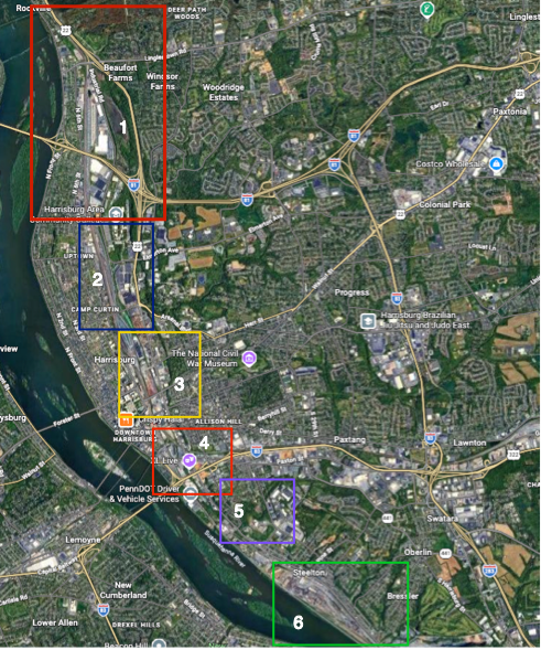
We explore 6 zones of EJ concerns in Harrisburg (zones 1-5), and we comment on zone 6 (Steelton), which was also redlined in the 1930s.
Redlining in Harrisburg
Redlining in Harrisburg began in the 1930s, but segregation likely began even earlier. Areas such as uptown and mid-town were considered the best parts of the city, with areas further south to Steelton considered the worst (see figure below).
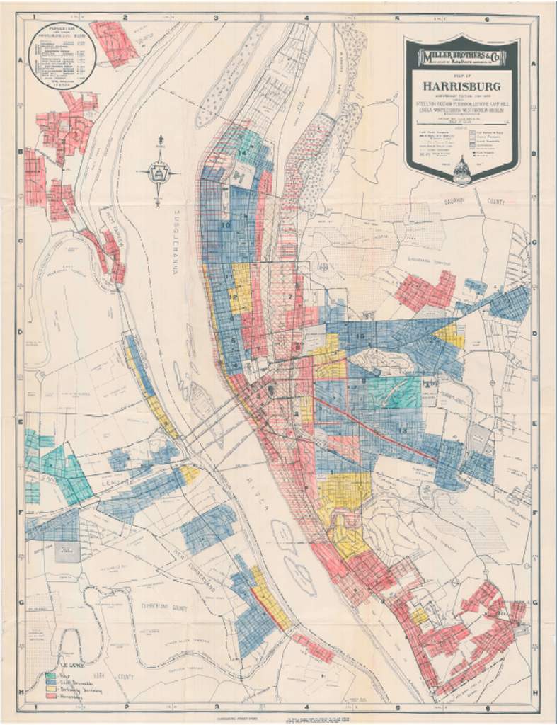
I wish that I didn’t have to harp on redlining, but it is so relevant to the present. In general, the areas where black and brown people were confined were subject to poor environmental conditions – located near polluting industries and near the Susquehanna River.
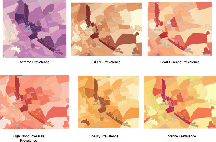
Examining the redlined figure from the mid-1930s and the health indicators today shows that the same areas that were redlined have the highest health burdens, such as Asthma, COPD, High blood pressure, and stroke. Coincidentally, this is where black and brown communities reside in 2026. The highest poverty and unemployment are also located in the same areas. As I stated in the last blog, redlining has impacted hundreds of cities across the United States. Let’s look at Environmental Hazards in Harrisburg.
Environmental Hazards in Harrisburg in relation to black and Brown neighborhoods
Roads
We don’t often think about road systems, but we should, because they often run through or near redlined cities—Houston, Philly, and Austin are just a few examples. Harrisburg has always been a transportation city because of its connections to other parts of Pennsylvania, such as Philadelphia, Erie, Pittsburgh, and Allentown. Now, it connects to Virginia and North Carolina, New York City, State College, and Baltimore. So all those highways add up to pollution from cars and trucks. But why is all of this traffic flowing into Harrisburg, a city of 53000?
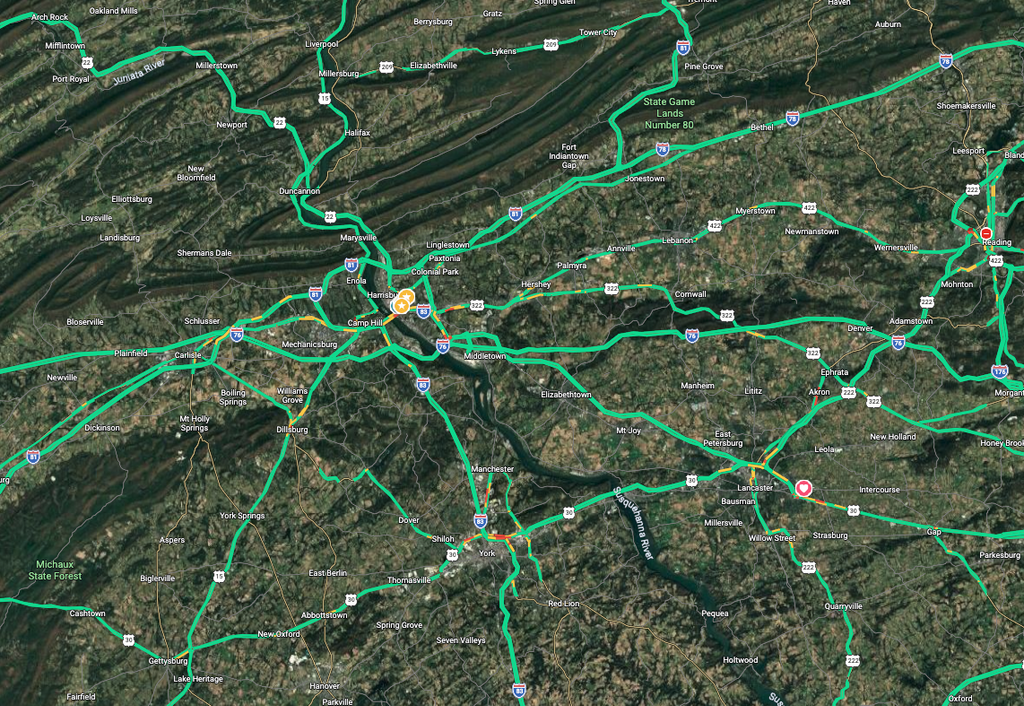
Car traffic – Harrisburg once had a population of nearly 90,000 in 1950 and then declined, with an estimated population of 49,000 in 2000. Where did everyone go? To surrounding towns and suburbs, with deindustrialization and white flight. Because the state government is in Harrisburg, every morning there are tons of traffic coming into the city from highways via I-83, I-81, I-76, and 322 east/west, followed by outflowing traffic in the late afternoon.
There is also heavy street traffic for folks trying to get to the highways or driving into town. This includes Cameron Street, State Street, Derry Street, Market Street, South 13 Street, 6th Street, Front Street, and Forster Street. Of these streets, Cameron Street is the busiest because it takes you to I-83 and I-81, while Forster Street leads to Route 11/15 once you cross from Harrisburg to the West Shore.
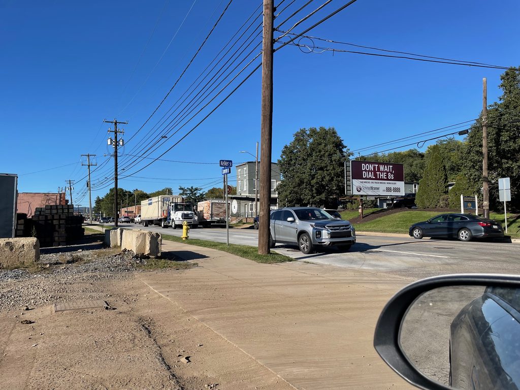
Unfortunately, diesel trucks and trains emit particulate matter, NOX, VOC, and CO, which can form ozone and may be affecting nearby neighborhoods. Cameron Street is located just west of Downey Elementary School, neighborhoods, and MW Smith Public Housing. To the east is a Black neighborhood where railroad tracks run near homes on 6th and 7th streets.
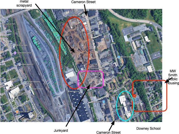
Cameron Street runs from Zone 1 through Zone 6 and transitions from 322/22 E/W as a highway and is designated as Route 230 from Harrisburg to Steelton. Truck traffic is designed to go to the railway-truck depot (Zone 1), and Cameron Street serves as a shortcut between Routes 81 and 83. Unfortunately, neighborhoods and schools to the east of Cameron Street are impacted by truck and car emissions
Transportation (Trucks and Trains)
Major train companies transport goods into Harrisburg every day, where they offload them to trucks that carry them in every direction via the highways.
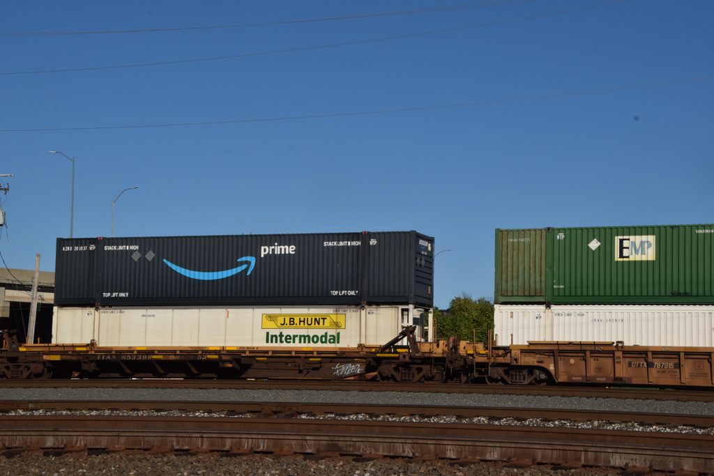
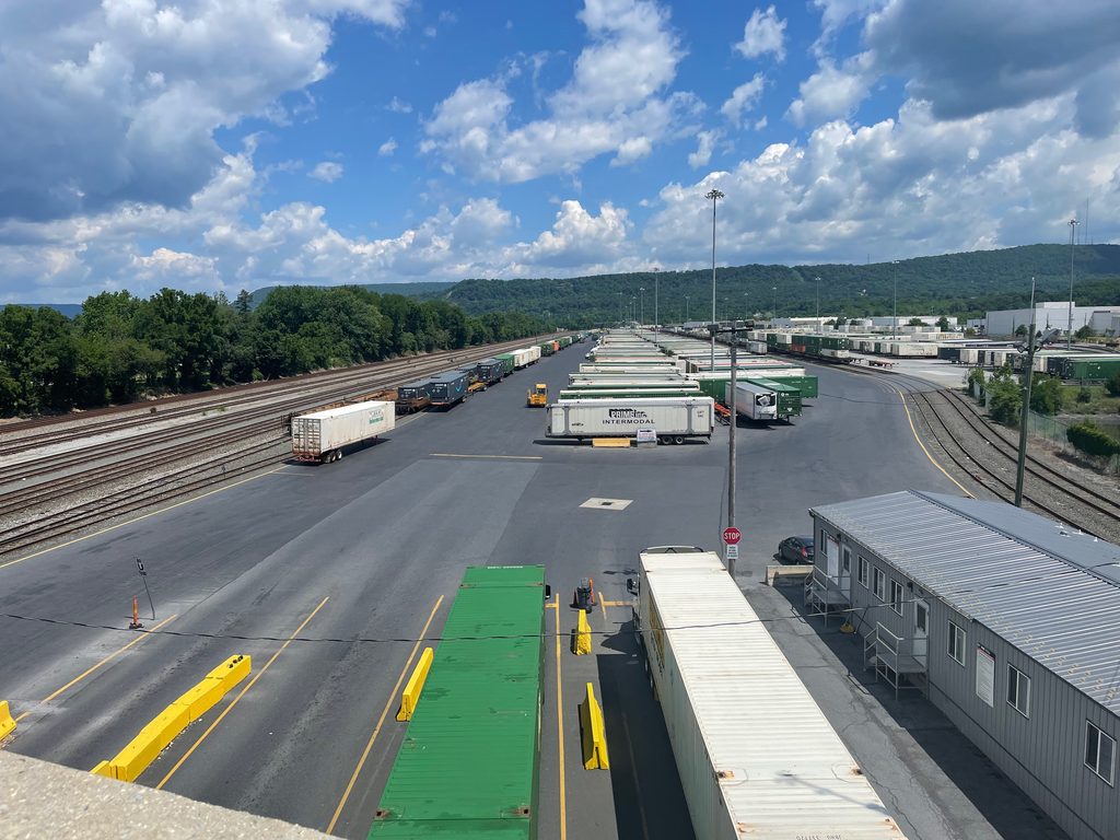
The scale of the process is hard to understand because so many trucks come into and leave Harrisburg each day from all directions. With all those trucks, trains must also enter Harrisburg frequently. The center of the action is on Industrial Road, which is located near Wildwood Park and the Harrisburg Community College (Zone 1)
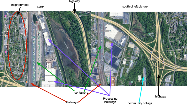
Caption: Possible sources of pollution in Zones 1 and 2
The satellite view suggests, the activity is likely to produce emissions that impact the nearby neighborhood to the west, visitors to Wildwood Park, the community college (HACC), and the area around this train-truck transportation hub. Sources of pollution include train emissions and braking, truck emissions, and pollution from processing goods. The trains run south through Harrisburg and then exits to other locations.
Industry
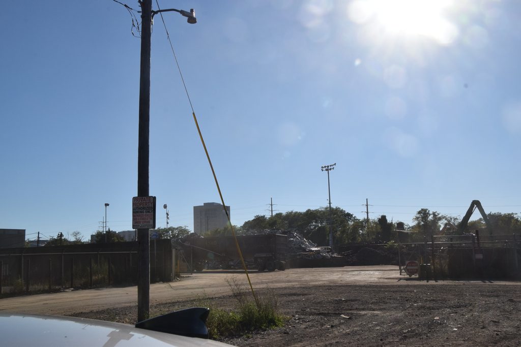
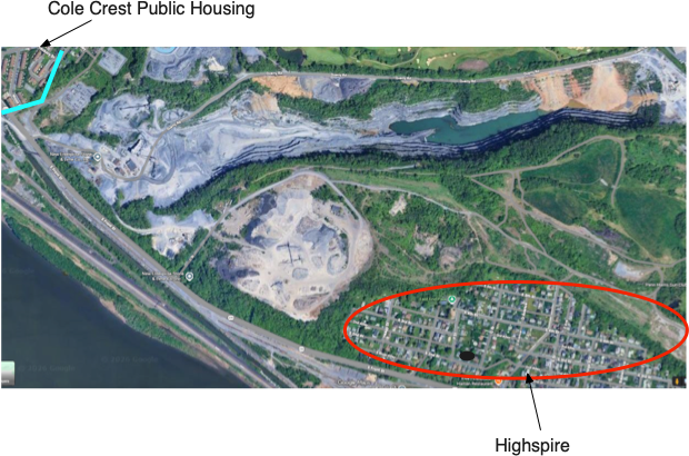
Harrisburg also has many potential industrial sources of emissions within the city. Some of it is related to the transportation sector (junkyards), but some is tied to scrap processing on Cameron Street. The industrial steel mill in Steelton recently shut down, and the quarry between Steelton and Highspire also contributes to pollution. Because the MW Smith Housing project and the Downey schools are nearby, they could receive particulate matter from this site, including dust, toxins and heavy metals.
Waste Management
The trash we make each day has to go somewhere. It goes to a landfill, an incinerator, composting, or recycling. The figure below shows that more than 50% of US waste is going to landfills, while 22% is recycled. Landfills are filling up so fast in the United States that one estimate suggests that there will be no available space in the 2030s. In general, industrialized nations produce the most waste, and wealthier individuals tend to produce more (how many bags of trash do you produce every week?). As you can see, the waste in the US goes to landfills, incinerators, or is recycled. Most of our waste isn’t recycled.
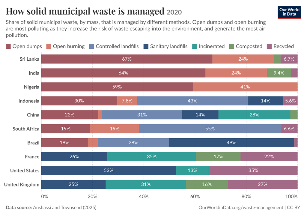
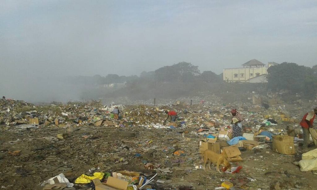
In contrast, Nigeria and many countries in Africa have uncontrolled landfills with threats to water, soil, and air in the surrounding communities. Burning trash in landfills threatens the respiratory health of people who live nearby and the people who work as trash pickers in these landfills.
However, the global picture of waste does not clarify that injustice has plagued communities of color in the United States through the mechanism of Environmental Racism. This is well documented and has continued for decades. The most comprehensive report on air pollution and communities of color is the 1987 United Church of Christ report on Toxic dumps in the United States. The genius team of Dr. Ben Chavis, Dr. Charles Lee, and Vernice Miller-Travis helped to provide the proof that Black and Hispanic communities were being targeted for the locations of toxic dump sites, brownfields, landfills, incinerators, and identified EPA Superfund sites.

In this eye-opening report, they highlighted how many millions of Black and Hispanic Americans were living near such facilities. This provided the legal and legislative pathway for communities of color to protect themselves. However, we should be clear that no such legislation has ever been implemented at the federal level; even in the Obama administration. Through the IRA, the Biden administration tried to address many of these ills through the Justice40 program and by seeking input from community members through the White House Environmental Justice Advisory Committee (WHEJAC). However, the current administration has destroyed much of what has been done in recent years. Next, we focus on potential Environmental Justice issues in Zones 4 to 6 of Harrisburg
I-83, South and East Harrisburg (Zone 4)
I-83 is a major route connecting to I-81 to the North, I-76 and I-283 to the east, and south to Baltimore. Every day, the highway is full of cars and trucks, especially during the morning and evening rush hour. Neighborhoods north and south of the highway are the recipients of car and truck pollution every day.
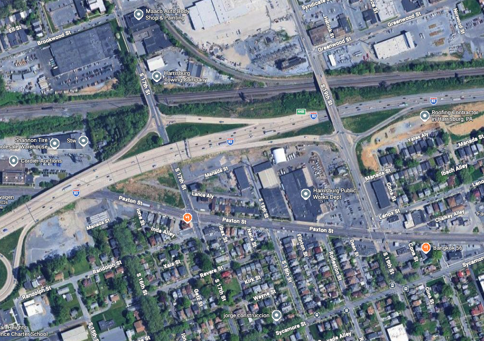
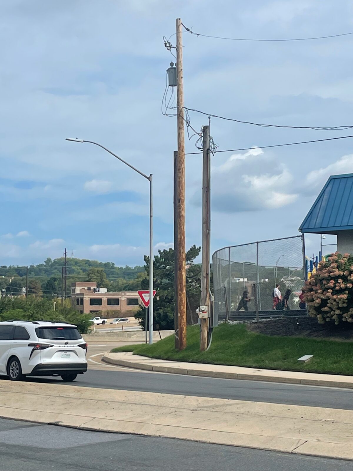
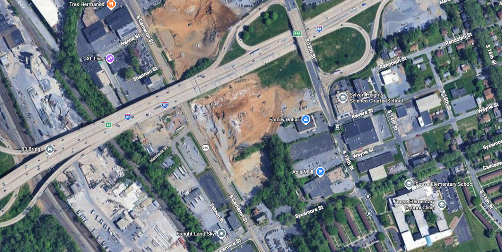
The opening picture shows Sylvan Heights Charter School with kids playing outside with I-83 in the background. South 13 Street is also very busy because it serves an on- and off-ramp for I-83 northbound and southbound. You can also see a neighborhood near Sylvan Charter School, and Foose Elementary is nearby. I guess that northerly winds would bring highway traffic pollution into these neighborhoods. All neighborhoods to the north and south of I-83 should be monitored for pollution, and that includes Sylvan Charter and schools along Derry Street (Rowland and Scott-not shown).
Hall Manor, Hoverter Homes and the Harrisburg Incinerator (Zone 5)
Environmental Justice brings us to important locations in South Harrisburg: Hoverter Homes, Hall Manor, and the Harrisburg Incinerator (Susquehanna Resource Management Complex). Susquehanna Resource Management Complex is owned by Reworld Inc. and it also accepts TVs, computers, and other appliances for recycling. Under most conditions, an incinerator would be located away from a neighborhood, but this one follows the United Church of Christ report on having these types of facilities in minority communities. Hoverter Homes and Hall Manor are both public housing with 233 and 540 units, respectively. Hoverter Homes was built in 1941 and Hall Manor in 1953. The incinerator was completed in 1972, long after Hoverter and Hall Manor. Reworld Inc., is also a headline news story in Philly, where its trash is sent to Chester’s incinerator (owned by Reworld inc). Councilwoman Jamie Gauthier wants the city to end its contract with Reworld Inc.
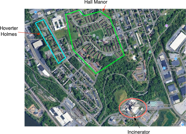
The incinerator is approximately 2 miles from Hall Manor and even closer to the neighborhood near Allison Street, the Islamic Center (and its school), and the Ivy Lane Apartments.
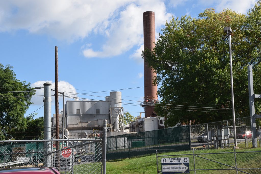
The Harrisburg incinerator made national news because it emits dioxins and transports them northward; researchers found dioxin in the bodies of Inuit people who live in the Arctic Circle, and the Harrisburg was determined the #3 source of dioxin traveling to the Arctic Circle in the United States (https://www.nytimes.com/2000/10/17/science/dioxin-in-arctic-circle-is-traced-to-sources-far-to-the-south.html?unlocked_article_code=1.H1E.K5Bu.mA31h4RDkinm&smid=url-share).
Closer to home, the residents of Hall Manor and Hoverter Homes are the most vulnerable because, based on the EJ Screen, which used data from the American Community Survey of 2018-2022:
Hall Manor
69% of the residents in Hall Manor are low income,
93% are people of color,
61% have less than a high school diploma,
62% live below the poverty line,
Adult asthma prevalence is 15%,
23% have disabilities.
Hoverter Homes
81% of the residents in Hall Manor are low income,
91% are people of color,
27% have less than a high school diploma,
59% live below the poverty line,
Adult asthma prevalence is 15%,
23% have disabilities.
50% are less than 18 years of age.
The setting fits the national pattern of Environmental injustice.
Zone 6 Steelton and Highspire
I know the least about Zone 6, but I know it had a steel mill, a railway ran through it, and it has a high percentage of people of color. It was redlined in the 1930s, and I have to assume that the air quality was pretty bad there while the steel mill was open.
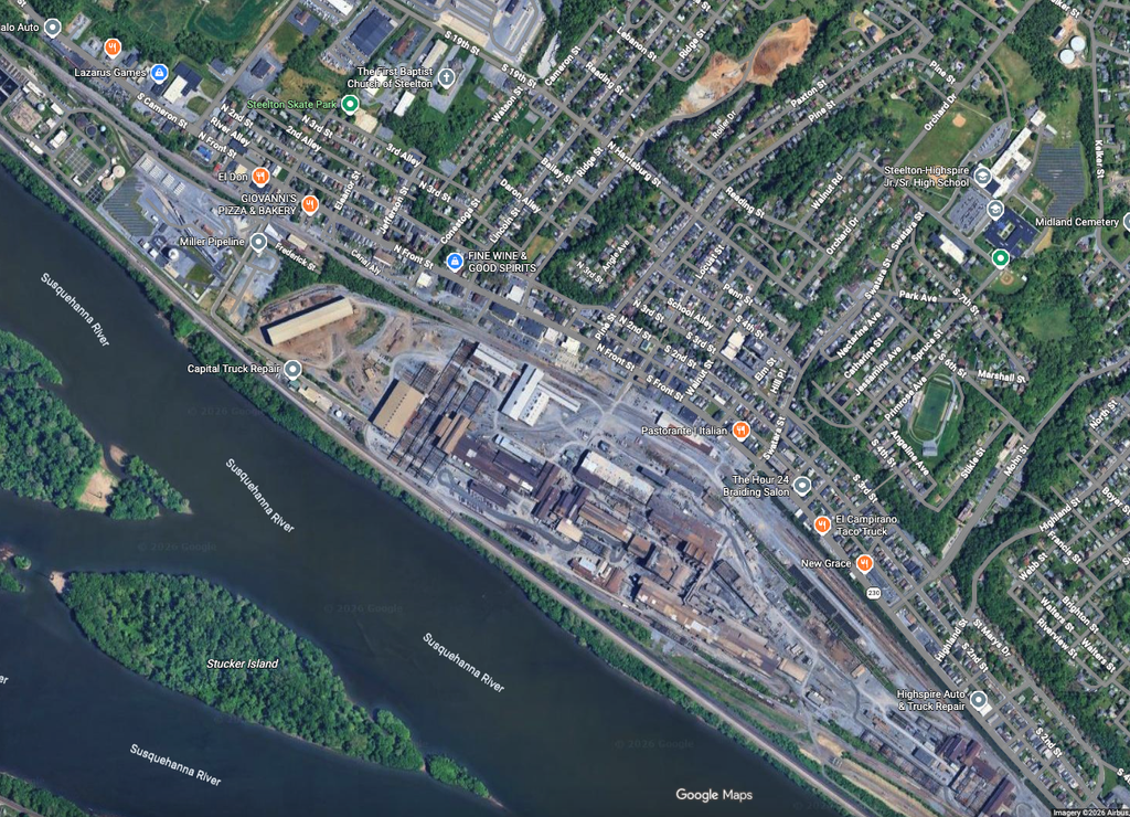
Quarry south of Steelton
A little further south of Steelton is a large Quarry. I assume mineral dust is lifted from this zone when work is ongoing and carried to Steelton and Highspire. Is it a source of Environmental Injustice????
CI4CJ Air Pollution network to monitor Emission Sources
Uncertainty exists about the potential sources of pollution and its impacts on the Harrisburg community because there is only one official reference station located south of the incinerator. This means the impacts of truck traffic, railroads, and highway pollution on Harrisburg residents are unknown. To address these concerns, my nonprofit, Community Innovation for Climate Justice (ci4cj.org), developed a high-spatial-resolution air pollution network focused on zip codes 17102, 17103, 17104, and 17110, which were formally redlined areas. The EPA funded this work through the Green & Healthy Homes Initiative (GHHI) Thriving Community grant. We are monitoring high-traffic areas around Cameron Street, the railway traffic near 7th Street, and the Hall Manor and Hovoter housing areas. Our network was designed to be near the locations of schools to: (1) provide real-time information to parents and schools about air quality using the Justair app(https://www.youtube.com/shorts/PsEmilCDw3A), where they can type in the name of their street or school to see air quality at the nearest station; (2) protect the youngest members of our society who need clean air for clear minds and lungs; (3) provide learning opportunities for teachers and students to use community air pollution data for education and research purposes.
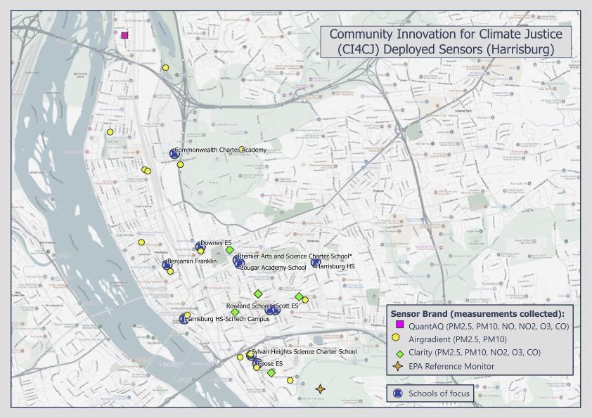
We also have our air pollution network in West Philly, which provides the community with real-time air pollution data that was redlined and discussed in an earlier blog.
.
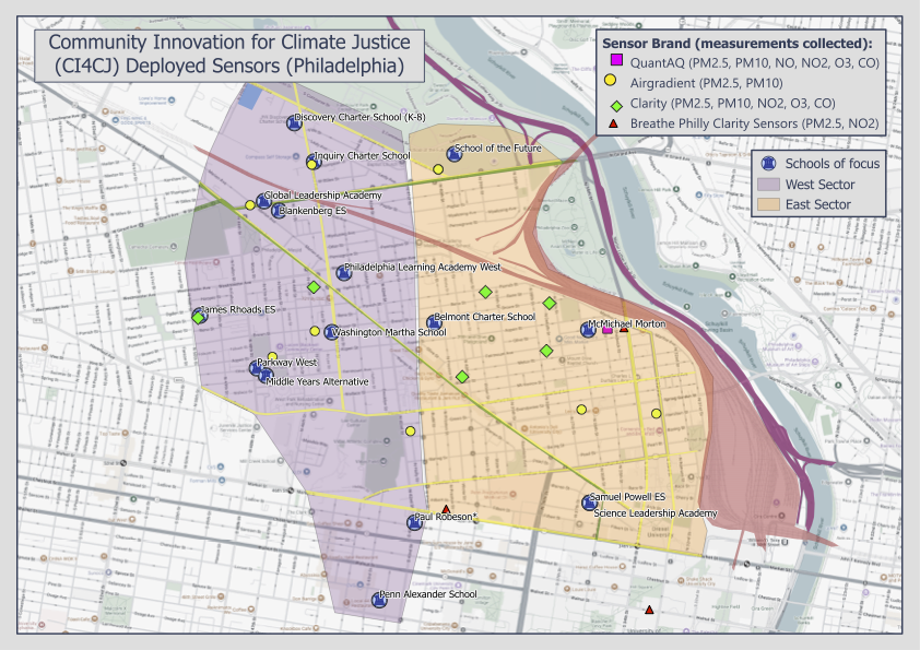
In summary, Harrisburg has all of the ingredients that have defined Environmental Injustice over the last 5 decades. I think we should make greater efforts to protect everyone from environmental harm, especially those who carry additional burdens. In the coming months, we will report our analysis of air pollution in both cities to the community in our newsletter. Stay tuned.